|
|
|
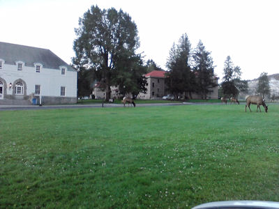
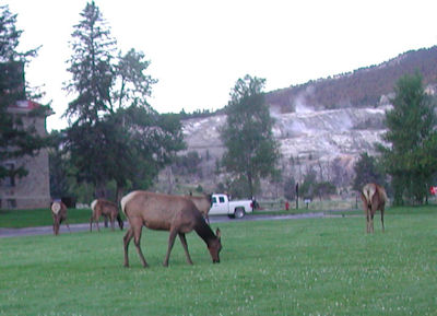
We took the road that went up and parked above the Hot Springs
|
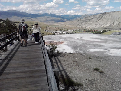
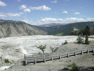
Lots of people walking on the boardwalk.
|
|
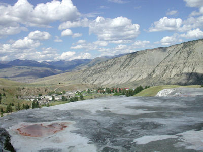
View is north, looking down on the buildings in Mammoth Hot Springs. This is the Gardinar River valley and further north, out of sight, is the town of Gardinar.
|
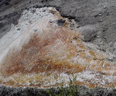
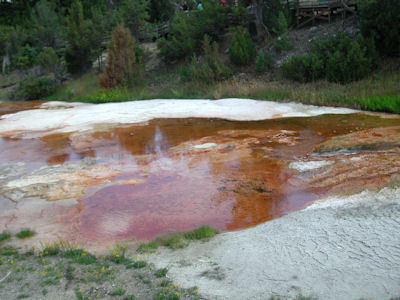
Close up of hot red water coming out of the springs
|
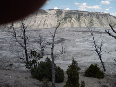
dead trees and some live trees growing in the rock and ash
|
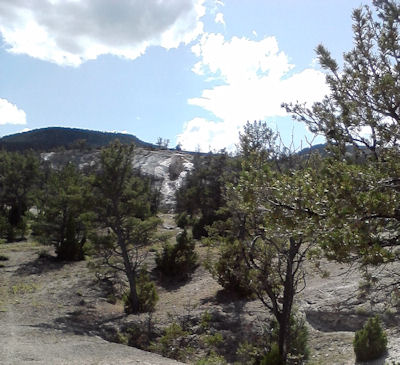
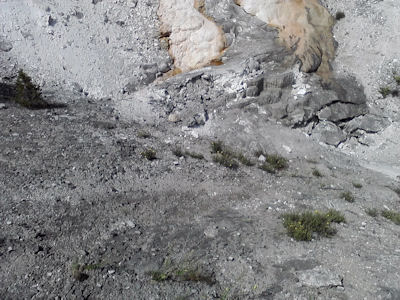
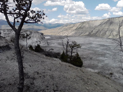
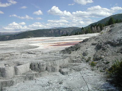
Much of the area where there used to be hot water from springs is now whitish rock. A big difference from when I visited in 1971 and there was lots of hot water running down the side of the cliff here.
|
|
|
Gardinar River Valley looking south. White area is where there were used to be water coming out of the hot springs.
|
|
a new red hot spring surrounded by green grass and live trees
|
|
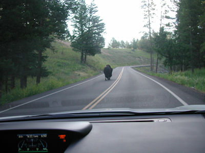
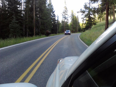
Driving from Tower Junction to Canyon Village we saw bison on the road several times. This road went over Dunraven Pass at 8859 feet with mountains near by, over ten thousand feet. Here the bison often travel on the road because it is easier, plus the rain running off the road provides more water for grass to grow next to the road.
|
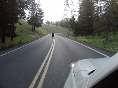
we waited until this male bison got a long ways ahead of us
|
|
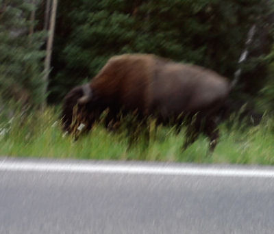
A bison eating on the side the road. We missed taking a photo of the bison who walked up to the front of our car. Stopped, looked around, then walked on past us. If we had had the driver's side window down, we could have touched him. He was taller than our car.
|
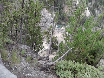
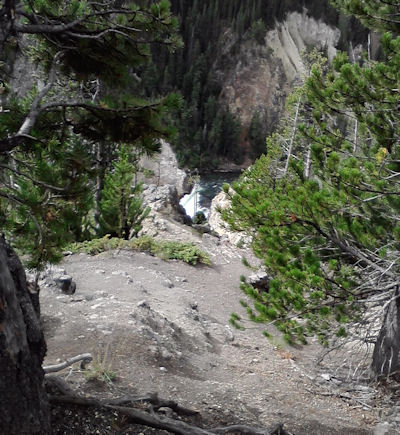
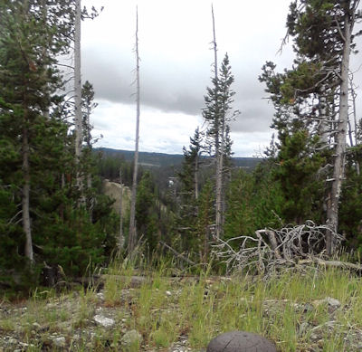
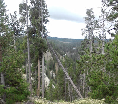
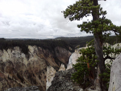
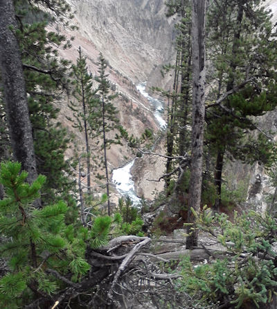
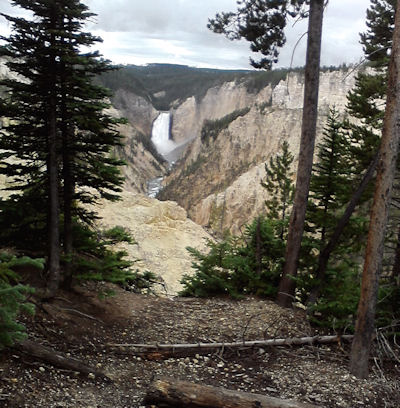
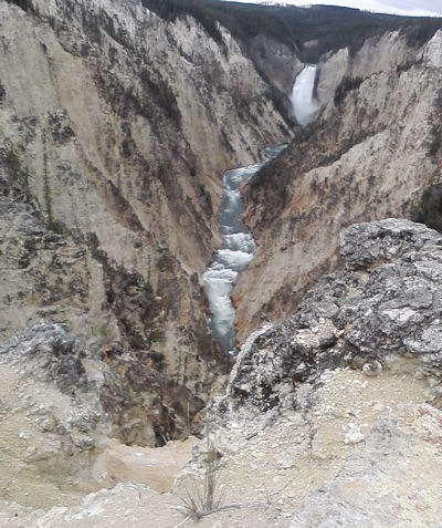
South of Canyon Village the Yellowstone River forms a huge canyon with two large falls, Upper and Lower. We took the one-way road following the north rim of the canyon, stopping at several parking areas, to walk on the trails to the edge. The river is a lot further down than it looks.
|
|
the white dot in the center is the upper falls with the bridge right above it
|
Barely visible is the bridge, the upper falls and in the center of this picture, the lower falls
|
the canyon walls are of several different colors with trees growing on the sheer cliffs
|
past the lower falls, the river narrows and zigzags north
|
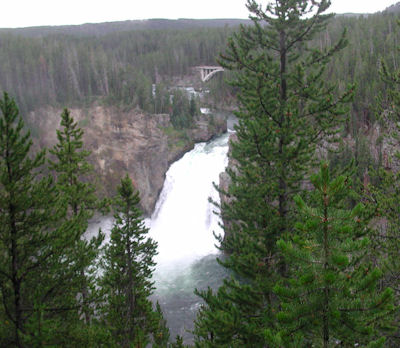
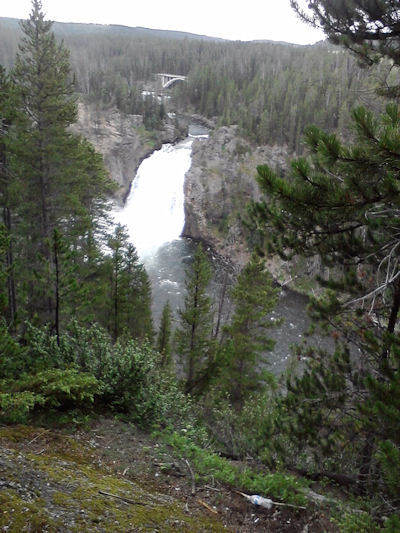
We drove back to the main road, went south and took the bridge across the Yellowstone river to see the canyon from the south rim. From the bridge, one can see how wide the river is, just before the river goes over the upper falls and into the canyon. These two pictures are taken from the south rim looking west towards the bridge and Upper Falls.
|
|
Both pictures are of the Lower Falls
|
|
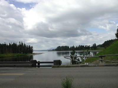
South of the Yellowstone Canyon, the main road follows the Yellowstone River south to Yellowstone Lake. This Lake is a natural lake fed by water from the mountains. This is a picture of the natural opening on the north side of the Lake, where the water flows out of the Lake to the north, forming the Yellowstone River. This is a picture of the highway 20 (which goes east to Cody) Fishing Bridge but because fish spawn here, fishing is no longer allowed.
|
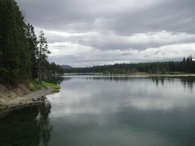
a view of the Yellowstone River from the Fishing Bridge looking north. The River here is quiet, clear and slow moving.
|
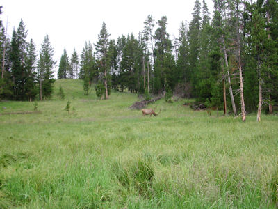
Below, a lone elk is grazing. Had a large set of antlers so likely was a male. We drove southwest along the western shore of Yellowstone Lake to West Thumb Junction, then headed west crossing the Continental Divide twice at over eight thousand feet.
|
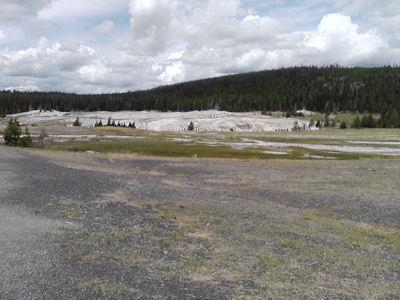
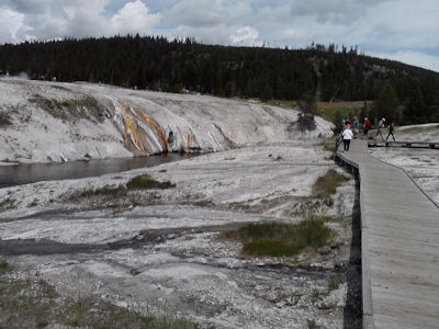
This is a small part of the geyser area around Old Faithful. Here we saw thousands of people, as there are hotels, campgrounds, restaurants, stores and several huge parking lots, which were full this afternoon. We finally saw a car pulling out and were able to park.
|
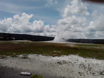
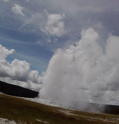
Old Faithful did erupt on schedule.
|
|
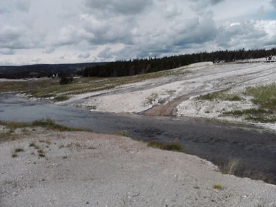
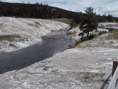
The hot water from the geysers including Old Faithful, drain into the Fire River. The area is fairly flat with boardwalks.
|
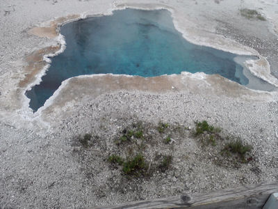
This is Blue Geyser
|
|
|
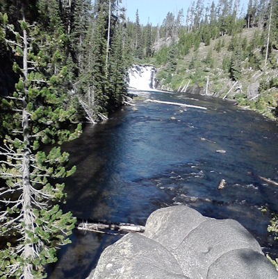
After two days in Yellowstone, we headed south on the only road to the Tetons, crossing the Continental Divide. This is Lewis Falls on the Lewis River which flows into the Snake River.
|
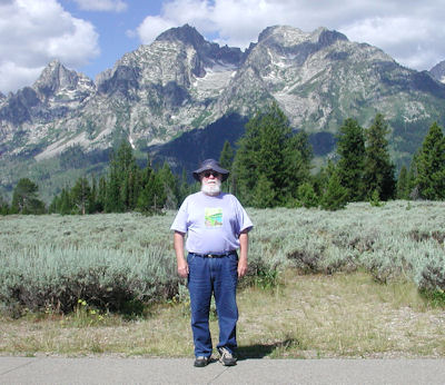
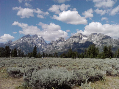
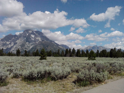
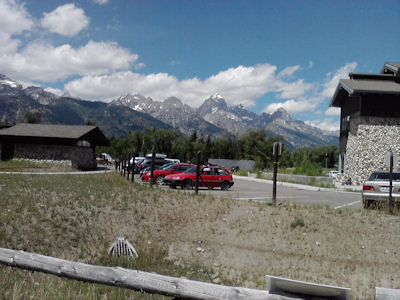
The huge Teton valley is fairly flat with the Snake river flowing south down the center of the valley. The Tetons are on the west side of the valley with several natural lakes near the base of the mountains.
|
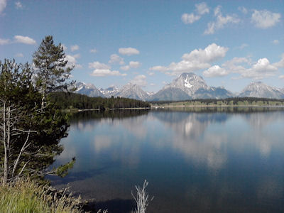
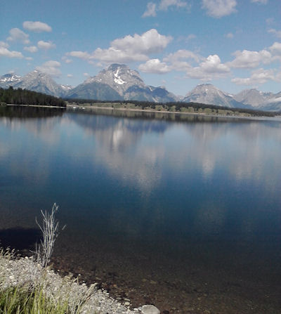
The Snake River flows into Jackson Lake. Even though Jackson Lake is a natural lake, there is a dam here to control the flow of the Snake river out of the lake.
|
|
|
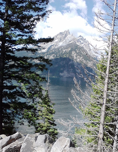
To the left is Jenny Lake. We saw more bison along the park road.
|
|
At Moose Junction we visited the museum and took a two hour raft trip down the fast flowing Snake River. Saw two Eagles from the raft; one eagle was on a sand bar eating a fish it had caught. Did not see any moose.
|